Apr 12, 2013

Port Darlington (Waterfront Trail)

Port Darlington is the part of the waterfront trail that will be of special interest to those who like boats and boating.  

These pictures were taken a few weeks back and we've gone through up until Port Hope at the Ganaraska lately.  If you want to check out the slip house here, you'll see plenty of different kinds of boats, and the variety of spars and masts reflecting off the water provide a photographer's paradise! 

If you're interested in fishing or simply in cruising the lake you can hire a boat at the Port Darlington Marina.  The restaurant nearby has a screened balcony, an ideal setting for a meal.  

Historically, this was once known as Port Darlington, and once among Lake Ontario's busiest ports, shipping millions of tonnes of grain, lumber, and other products annually.  While one wharf houses a grain elevator and was used for industrial shipping, the other welcomed the passenger steam ships that called daily.  The port was so busy that the wagons that carried the produce had to wait their turn at the docks!  Remnants of the once stately Victorian summer cottagers are here, as it was once a very popular vacation spot.  

The Master's House located on Port Darlington was bought by the Municipality of Clarington and the community hopes to turn this into a Museum to show all the artifacts and display the community's early history.  So, if you are still reading this, I would guess like me you might be interested in history as well.  Here's another great trip to take:  Venture eastward onto East Beach Road and it will become easy to understand why this was a good area in the 1880s and 90s for people thinking of buying a cottage as the view is breathtaking.
 
We will be back, and I suggest waiting for another few weeks at least to come here as the ideal way to travel along East Beach Road is on bike or foot, so you can stop frequently to enjoy the view. 

I'll try to map out a better description with more colorful pics as the weather becomes more pleasant, or you can discover your own journey here.  


Cedarvale Park

Glen Cedar Bridge
So here we are at the end of the exact location of where the Kay Gardener Trail begins (or ends). Looking at the map at the corner of Allen Road and Eglinton Ave West, we decided to head southbound towards Eglinton to see where it would take us. 

I had this idea of going to Casa Loma, but it was so late in the afternoon, so we probably wouldn't get much time to spend in there, so we found ourselves on a street called Everden with some very architecturally unique homes on it.  Up ahead was some familiar Toronto Parks signage 'Cedarvale Park'.  I've never been before so with enough light left in the day, we headed on through and decided to continue south instead of backtracking.  

interesting architecture
This was a surprisingly large and beautiful find in Toronto.  It was bordered by steep hills with an almost valley like appearance with a deep ravine with steep sides.  There were a few people taking advantage of the low winds to fly kites.  Because of its proximity between the Beltline Trail in the north (where we had just come from) and the Nordheimer Ravine to the South, the Cedervale Park with his heavily used footpaths make a very large trail system through central Toronto.


Historically speaking (well you knew I would eventually come to it..), Ernest Hemingway often walked through here during his stay in Canada.  There was once an idea to building mansions here, but the Great Depression put a hold on that one.  The Glen Cedar bridge (seen below) was built during the Depression and was restored about 20 years ago from demolition.  There were plans to build an expressway through this park, but successful lobbyist prevented the construction project from moving forward.

I can just imagine Hemingway sitting under this tree..
With the awareness through the 2000s of the ecological impacts on the environment, the City of Toronto and other major cities and its people have changed their priorities to undertake re-naturalization projects instead. 
where's your boots cowboy?


Apr 11, 2013

Kay Gardner Beltline Trail (Toronto Beltline Railway)

Great terrain for biking, hiking and brisk walks
Springtime in Ontario has always been typically unpredictable.  As Canadians, our weather complaints are that it is either too hot or too cold, so when the day is just right you just have to get out there, especially after a particularly clingy winter.

The Kay Gardner Beltline Trail was discovered by us purely by chance, and not by choice as one would have it.  It extends from Yonge at Davisville to Allen Road in the West end, covering about 4.5 kilometres.  You will love this trail if you want to take it easy and go for a jog, a walk or bike ride as the terrain is flat with very few elevations.  The surface itself looked to me like a mixture of packed soil which got me thinking of the historical aspect of it as it was carved through trees, was narrow and long and even. This must have been an important roadway or railway.

Houses located just to the side of the path
After some quick review, it was very well documented as the Toronto Beltline Railway, built in the 1890's.  The main purpose was to promote the new suburban neighbourhoods north of city limits.  These neighbourhood are now well-known as Rosedale, Moore Park, Forest Hill and Swansea, all extremely well to do upper-middle class to high society areas too.  As this was once considered a suburban area 'north of city limits' it is today urban and centrally located, more or less.

A cool squirrel gives me the rock-on sign
An interesting historical fact is that the Toronto Beltline Railway was once necessary because the current bridges didn't exist at the time, and access to these neighborhoods were very restricted as you would have to go through very steep ravine roads to get to them. Read up more on these illustrated facts about this railway found here.

Robins are everywhere now


So how did the Toronto Beltline get its current name?  Well, Kay Gardner and her husband moved to Toronto in 1961.  She had worked tirelessly, first as a citizen volunteer, and then as a City Councillor.  Not only was she an advocate for her community and its residents, but she made special considerations for the senior citizens.  She was the main advocate of the city's acquisition of the Beltline and its conversion to park land. In recognition of her vision and commitment to people and community, the City of Toronto renamed the this trail the "Kay Gardner Beltline Trail" in May 2000.  From one end to the other you will see maps and plaques commemorating her contributions.

As we came to the end of the Kay Gardner Trail (at Allen Expressway), we went south on Allen Road to Everden Road, where it takes you through some more gorgeous scenic parkland, known as Cedarvale Park.

Just an FYI: the trail continues from Allen Expressway west of Allen Road but is called the York Trail which passes through to the Kay Gardner Beltline Park.

Mar 27, 2013

Port Hope (Waterfront Trail)


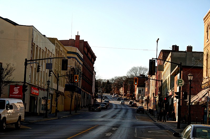
Port Hope is a lovingly restored and maintained historical town with over 16,000 people.  

Port Hope and its residents are still so determined to preserve its fine architecture and small-town way of life too.  

They are a member of the Green Communities Initiative, which promotes the greening of Ontario by encouraging its member to increase energy and water efficiency, reduce waste and prevent pollution.


We didn't spend a lot of time here, on borrowed time before sunset, but wanted to share a few pictures, like the 

Port Hope Rapids, which is not really considered a waterfall, but rather more like several low rocky steps spread out along for almost a kilometre.  This comes from along the lowest parts of the Ganaraska River (you can search more on the Ganaraska Forest in this blog).


You can catch the Ganaraska Trail if you head north on Queen Street, which runs behind this historic town.  It takes about 45 minutes each way.  

Speaking about warming up a bit more, every April, Port Hope hosts a zany "Float Your Fanny Down the Ganny Race", with canoes and kayaks as well as small armada of homemade crazy crafts to commemorate the 1980 flood of the Ganaraska river.


Contact Form

Name

Email *

Message *