Mar 27, 2013

Port Hope (Waterfront Trail)


Port Hope is a lovingly restored and maintained historical town with over 16,000 people.  

Port Hope and its residents are still so determined to preserve its fine architecture and small-town way of life too.  

They are a member of the Green Communities Initiative, which promotes the greening of Ontario by encouraging its member to increase energy and water efficiency, reduce waste and prevent pollution.


We didn't spend a lot of time here, on borrowed time before sunset, but wanted to share a few pictures, like the 

Port Hope Rapids, which is not really considered a waterfall, but rather more like several low rocky steps spread out along for almost a kilometre.  This comes from along the lowest parts of the Ganaraska River (you can search more on the Ganaraska Forest in this blog).


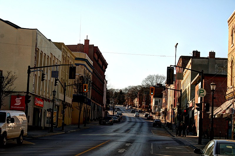
You can catch the Ganaraska Trail if you head north on Queen Street, which runs behind this historic town.  It takes about 45 minutes each way.  

Speaking about warming up a bit more, every April, Port Hope hosts a zany "Float Your Fanny Down the Ganny Race", with canoes and kayaks as well as small armada of homemade crazy crafts to commemorate the 1980 flood of the Ganaraska river.


Mar 17, 2013

Presqu'ile Provincial Park (Waterfront trail)


Well as you may well have discovered by now in Canada, an over enthusiastic spring outing after a long winter's chill can sometimes mean you venture out too soon...as we recently found out while  revisiting Presqu'ile Provincial Park in Brighton.   

What can I say? The sky overhead was azure blue, and the sun peaked out from the clouds more often than not, but still my fingers chilled to the bone in no time and sometimes trying to take photographs was actually quite painful.  I love to take photographs, and lost my fingerless gloves, or rather forgot to bring them, I forgot that too.

The Presqu'ile Provincial Park caught my eye on the map for several reasons, the lighthouse was one.  It was built in 1840, located just at the southern tip of the peninsula, it is the second oldest still operating in the Canadian side of the Great Lakes.  Until 1872, William J. Swetman, the first lighthouse keeper, alerted passing ships to the presence of landConverted to electrical operation in 1935, the lighthouse no longer needed a keeper by 1952.  
 
Presqu'ile is Ontario's fourth oldest provincial park. It was created in 1922 for the sole purpose of protecting distinctive habitats and to offer city-dwellers an opportunity to experience and enjoy the natural heritage that is so much a part of Ontario's history.  

Here there are over 400 campsites, several beaches, a walking and cycling trail, boat launches and cross country trails in winter.  The asphalt road winds its way throughout and you imagine this over 17 km area is booked all summer, which is another reason to get a sneak preview.

Unlike the western shorelines beach, most of the eastern shoreline is made up of natural marshland. In fact there is over 161 hectares of wetland that stretches along Presqu''ile bay, making it the largest protected wetland on the north shore of Lake Ontario.


Making several stops along the way, this was the highlight of a very late winter and very early spring.

Mar 12, 2013

Desjardins Canal and the Railway Disaster (157 Years Ago Today)

 History Today: Exactly 156 years ago today, on March 12th in 1857 marks one of the worst rail-way disasters in Canada to that date.  It carried about 100 passengers on board, of which 59 were instantly killed and leaving 18 more injured.


There have been may historical depictions of the disaster of the Great Western Railway passenger since this day.  

 More recently a digitized project was undertaken by the Hamilton Public library to map out the original booklet that outlines much like a forensic study of the disaster.  If you go online you can see a copy of the "Full Details of the Railway Disaster of the 12th of March, 1857 at the Desjardins Canal on the line of the Great Western Railway"

 This is what the Desjardins Canal bridge looks like today.  There is a historical maker on the path just underneath the High Level bridge that commemorates the Dejardins Railway Disaster.  The marker is on the bike path in Cootes Paradise, a wonderful natural setting which overlooks the Hamilton Harbour from up top and a recreational trail down below


Carp barrier - keeping adult carp at bay